

Local Boat Ramps
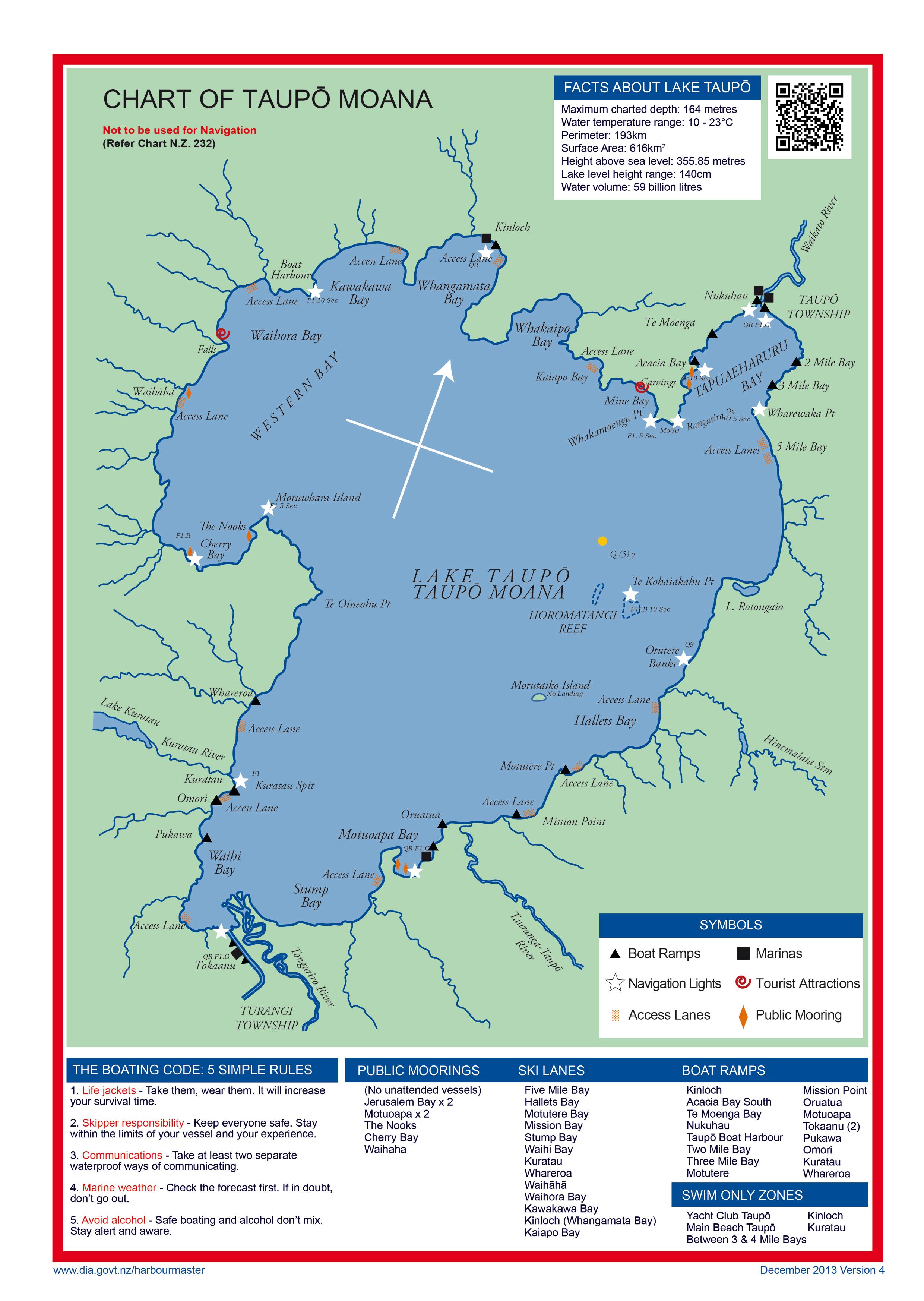
Lake Taupo is situated in the North Island of New Zealand. With a surface area of 616 square kilometres, it is the largest lake by surface area in New Zealand, and the second largest freshwater lake by surface area in Oceania after Lake Murray (Papua New Guinea).
Lake Taupo has a perimeter of approximately 193 kilometres, a deepest point of 186 metres, and contains approximately 59 cubic kilometres of water. It is drained by the Waikato River (New Zealand's longest river), while its main tributaries are the Waitahanui River, the Tongariro River, and the Tauranga Taupo River. It is a noted trout fishery with stocks of introduced brown trout and rainbow trout.
Boat Ramps
A ramp permit is needed to use the Department of Internal Affairs' ramp facilities. Permits are available online (https://ramp-permit-taupo.dia.govt.nz) or from most local dairies or service stations. An instant fine of NZ$200.00 will be imposed for using a ramp without first getting a permit. Kinloch Marina has a separate ramp permit.
Ramps giving access to Lake Taupo are situated at:
- Kinloch - Private
- Acacia Bay South
- Te Moenga Bay
- Nukuhau
- Taupō Boat Harbour
- Two Mile Bay
- Three Mile Bay
- Motutere
- Mission Point
- Oruatua
- Motuoapa (x3)
- Tokaanu (x2)
- Pukawa
- Omori
- Kuratau
- Whareroa
Hyperlink to Boat Ramps
https://www.dia.govt.nz/vwluResources/Lake-Taupo-Chart-2013/$file/Lake-Taupo-Chart-2013.JPG
Download the MarineMate app for Android or iOS. If viewing this on a smartphone or tablet, click on the appropriate store icon below to download.


For more information about boating and fishing on Lake Taupo, please visit the Harbourmaster's website »